Introduction
Though little remains of the old Harlem and its natural beauty that once inspired Hendrick de Forest to name his farm Vredendael—a name meaning “peaceful dale”—there remains much in the available sources that help to tell a story, incomplete as it may be. The record begins with the indigenous population that inhabited this part of Manhattan Island before the arrival of the Europeans, who gave descriptive names to many of the local sites, including those found in the early patents of Vredendael, names that are mentioned in no other record or document. Here also can be found the names of tribal elders who lent their signatures, relinquishing their rights to land that once encompassed this farm. There is also an early surviving lease of Vredendael that gives a list of the farm’s contents as well as what crops were being grown, lending insight into a 17th-century bowery, or farm, in the Dutch colony of New Netherland. In addition to the above documents, there is much to be found in the iconography, which gives one perspective of the geographical layout of the land as well as clues to the location of the first European-style home built in Harlem. Together, these sources provide a keyhole view into our past.
Pre-European History
The indigenous populations that occupied the upper part of Manhattan Island at the time of contact with the first European colonist were known as the Reckgawawancs, “probably from the name of their sachem Rechewac”. BOLTON 1904 The Reckgawawancs were a sub-clan of the Weckquaesgeek,1 both sub-groups of the Algonquian-speaking Wappenger Tribe. These were river and coastal-dwelling people who seasonally moved from one hunting and fishing ground to another. They are not thought to be the ones who sold Manhattan Island in 1626 for the so-called “twenty-four dollars in beads”2… Those are believed to have been of the Canarsee band. The Reckgawawancs, on the other hand, still claimed parts of upper Manhattan Island until at least 1715.Bolton 1908 p108 In addition to their claims on Manhattan, the Reckgawawancs also held claim to parts of the West Bronx and to parts of Yonkers.

Location of Vredendael
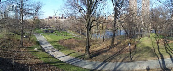
The Island of Manhattan, in the indigenous tongue meaning “the island of hills”, is long and narrow, stretching from North to South, at length being approximately 13.4 miles, and at its widest 2.3 miles. Traversing the length of the island, long before it became the King’s Bridge Highway, was the Wickquasgeck Trail, a path carved out by animals and the indigenous population centuries before the arrival of European explorers. In Central Park, you can still see the hills and rugged heights that once graced much of the island. Looking out from atop the heights of Fort Clinton in modern-day Central Park, one could have seen the two tracts that comprised Vredendale. The first of these sections was called “Muscoota” by the local Reckgawawancs, and the second was called “Rechgawanes”.
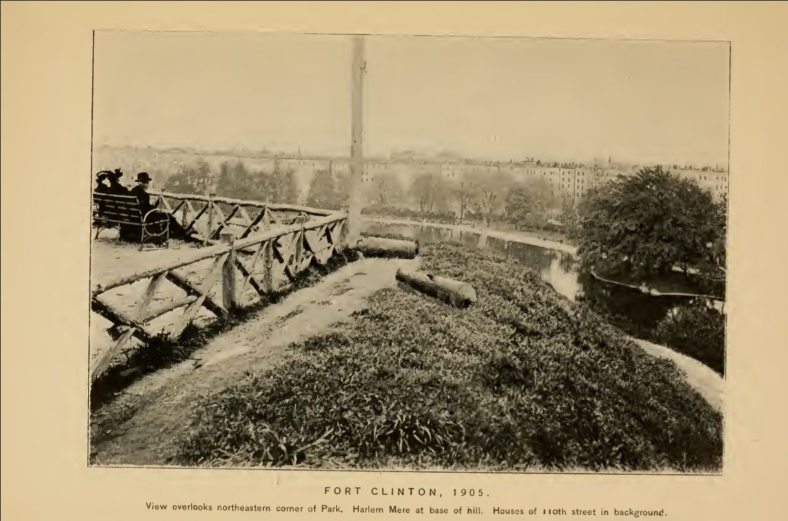
ABOVE: View from Fort Clinton, Central Park. BELOW: The two sections of Vredendael.
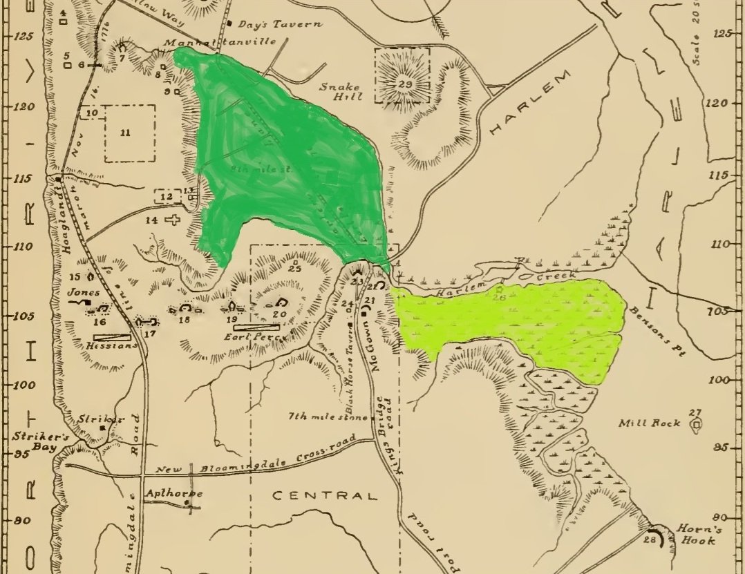
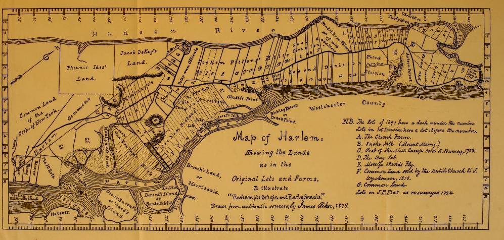
ABOVE: Riker’s Map of Harlem BELOW: Map of New York City and Manhattan Island with the American defenses in 1776, Compiled by Henry P. Johnston (1878).
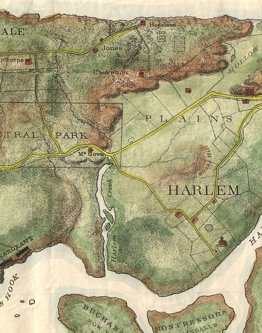
“Muscoota”, meaning “flat land”, was also known by early colonists as “Montagne Flats”. These flat lands were highly desired by the Dutch colonist for their fertility. This section of Vredendael that occupied part of Harlem Plains was somewhat in excess of two hundred acres, or one hundred Dutch morgen. It extended from approximately present-day 109th Street to 124th Street; bounded on the Northeast by the now subterranean Harlem Creek; on the West by the cliffs of Morningside Heights; on the South by the hills that help to define “McGown’s Pass“, just beyond the small creek once known as “Montagne’s Fonteyn”,3 remnants of which still grace the northern tip of Central Park. Yet with what little is left one can only imagine the early morning sun gleaming through the rising mist, its verdant green meadows bounded by tree-filled hills and crystal clear streams, flush with deer, rabbit, turkey and other game birds, with the sweet scents of Spring—sights, sounds, and smells, all of which once inspired the tranquil name, Vredendael.
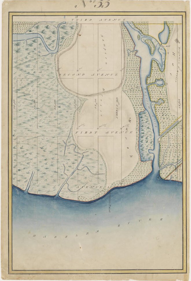
The second section of Vredendael was called Rechgawanes, said to mean “sandy point” in the indigenous language. It was also known as “Montagne Point” and later “Benson Point” to the colonials. This was mostly a tidal swamp with a ridge of land made of sandy loam estimated to have been fifteen to twenty feet above sea level, that jutted out to the East River, its location given in deed is as follows…” the Point named Rechwanis, bounded between two creeks, and hills, and behind, a stream which runs to Montagne’s Flat; with the meadows from the bend of the Hellegat to Konaande Kongh”RIKER p258, BOLTON 1909 p105 4 5
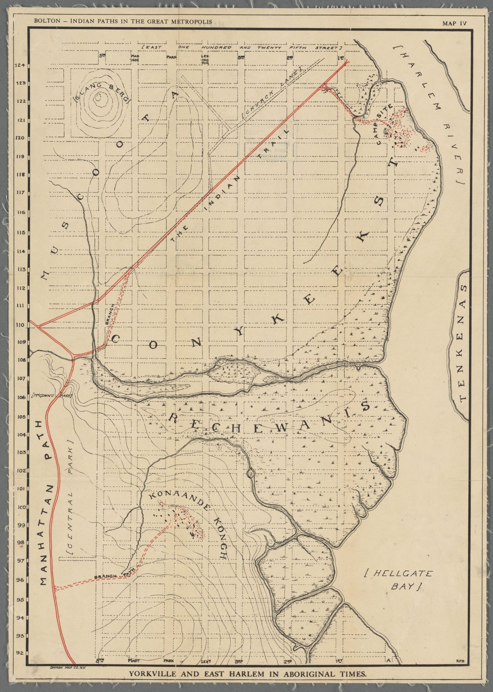
Lionel Pincus and Princess Firyal Map Division, The New York Public Library. “Yorkville and East Harlem in aboriginal times, Map IV” New York Public Library Digital Collections.
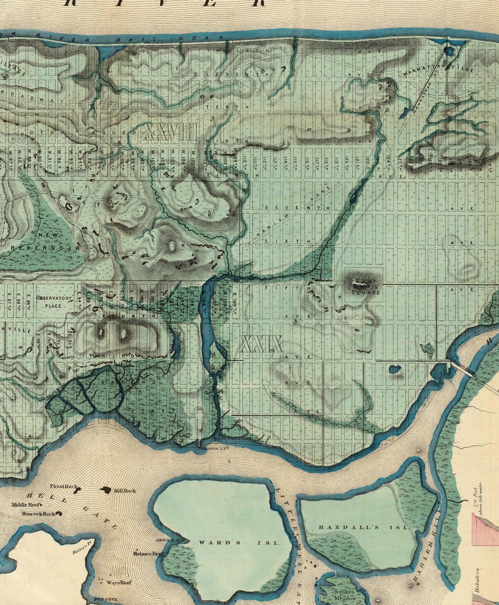
The creek on the North side of the point was the Harlem Mill Creek, also called Montagne’s Kill. The second creek, or kill, described, but left unnamed in this deed, is depicted on several maps which attempt to reconstruct the ancient topography of the land. On the East, the point was bounded by “the Bend of Hellegat”, or “Hell Gate“.6 We can only assume that the final landmark given, Konaande Kongh, is positioned as the remaining western boundery of Rechgawanes, and that this site would be the eastern hills that grace “McGown Pass”, including what is now the remains of “Fort Clinton”.7
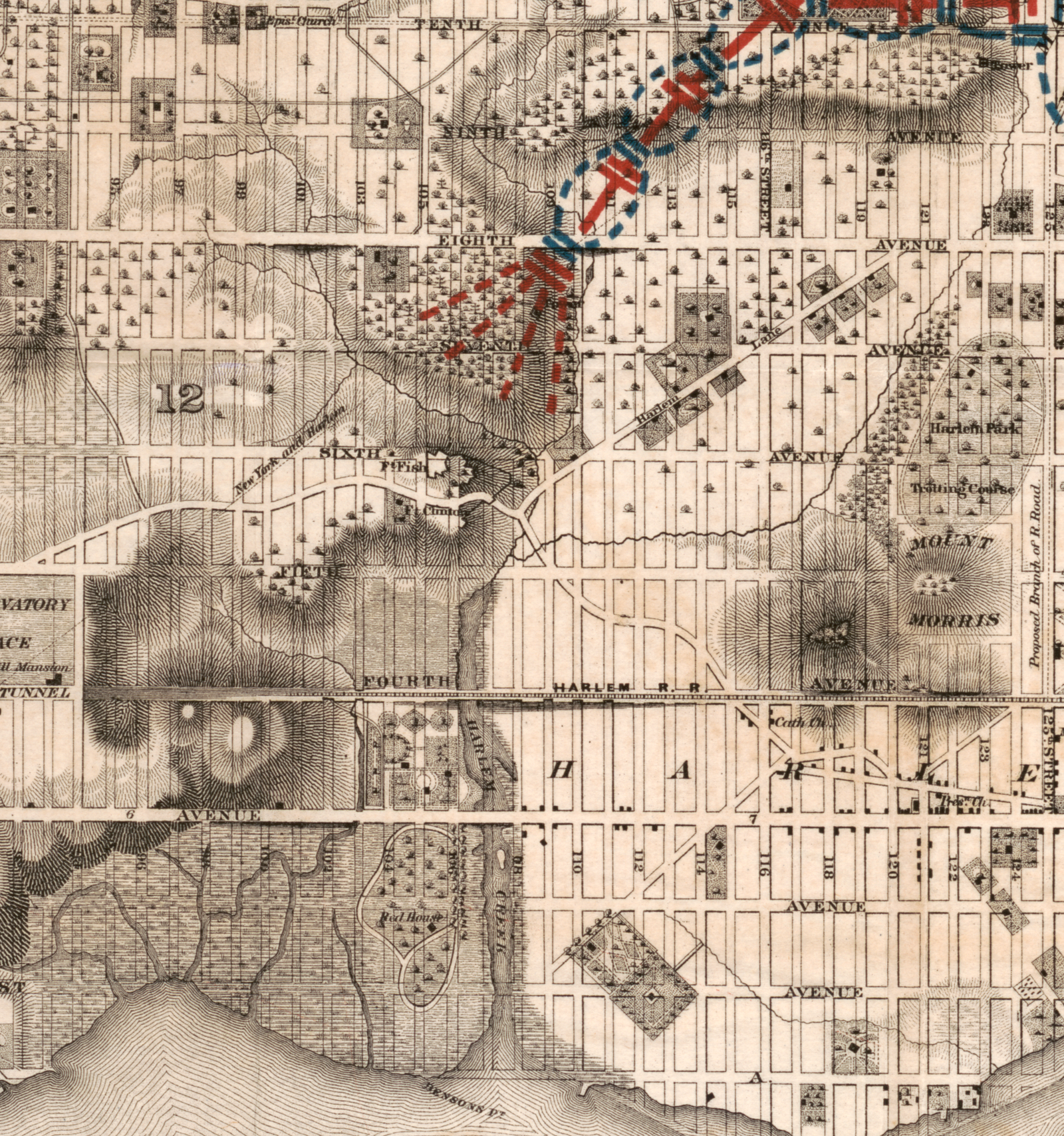
ABOVE: Map of the Upper Part of the Island of Manhattan. BELOW: Topographical map of New York City, county and vicinity: showing old farm lines etc. (1854).
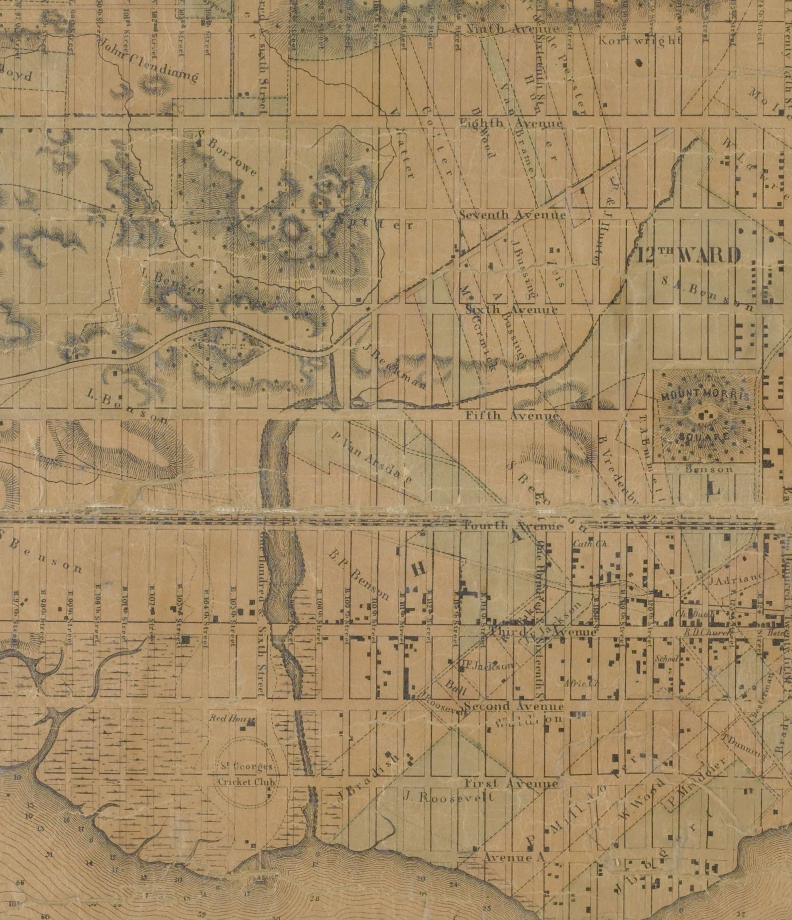
However, in contrast to this, Bolton, who was perhaps the foremost expert on Native American villages and place names on the Island of Manhattan, gives the following: “The native village was known as Konaande kongh and was probably situated on the high ground between Madison and Lexington avenues at 98th to 100th streets.BOLTON 1922 p68 8 However, this assumption of Bolton would leave the western demarcation of Vredendael unaddressed. 9 Riker, who also speculates upon both its name derivation as well as its location, gives the following regarding Konaande Kongh: “An Indian term which occurs in a Dutch document of 1669… It may come from ko, a fall or cascade, and ononda, a hill; kong signifying an elevated place or locality. Hence, probably refers to the spring aforesaid, but possibly to a village site (an Indian village, or perhaps the one contemplated in 1661), nunda being the term for village. It approaches in sound nearly to the Iroquois Genunda, or Kannata, Village on the Hill, and from which, says Charlevoux,10 the name Canada is derived.”RIKER p122 fn Unfortunately, there is little further comment found on Konaande Kongh.11 12
Location of the Homestead
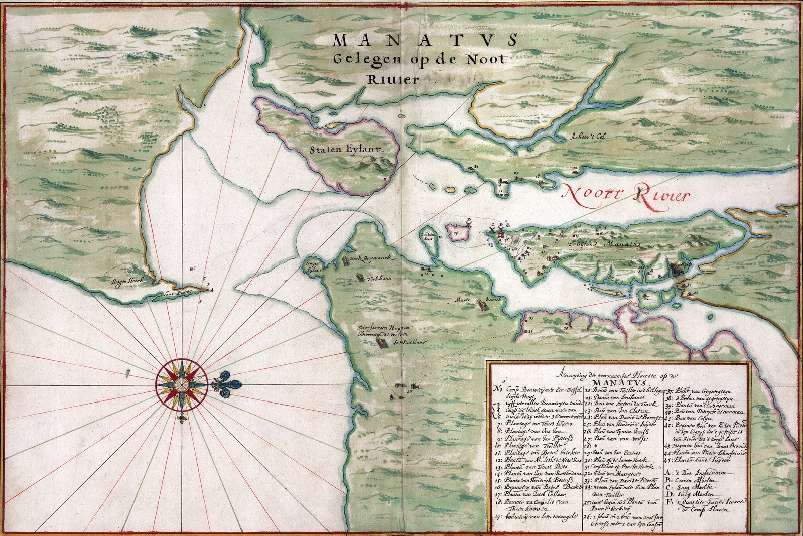
Few sources give clue to the site of the deForest/LaMontagne homestead. Of contemporary sources, we have three copies of the Manatus Map that give some indication of its location circa 1639. Though these are quite vague depictions, they do appear to place the homestead just south of the confluence of Montayne’s Rivelet and Harlem Creek.
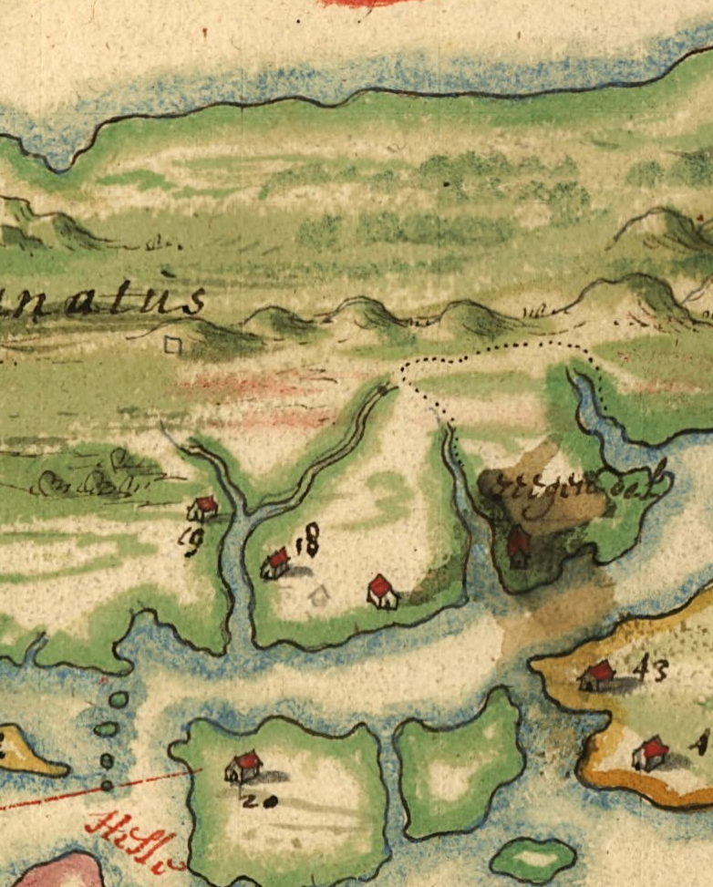
ABOVE: Harrisse copy of the Manatus Map held by Library of Congress (c1639). The homestead is No.19.
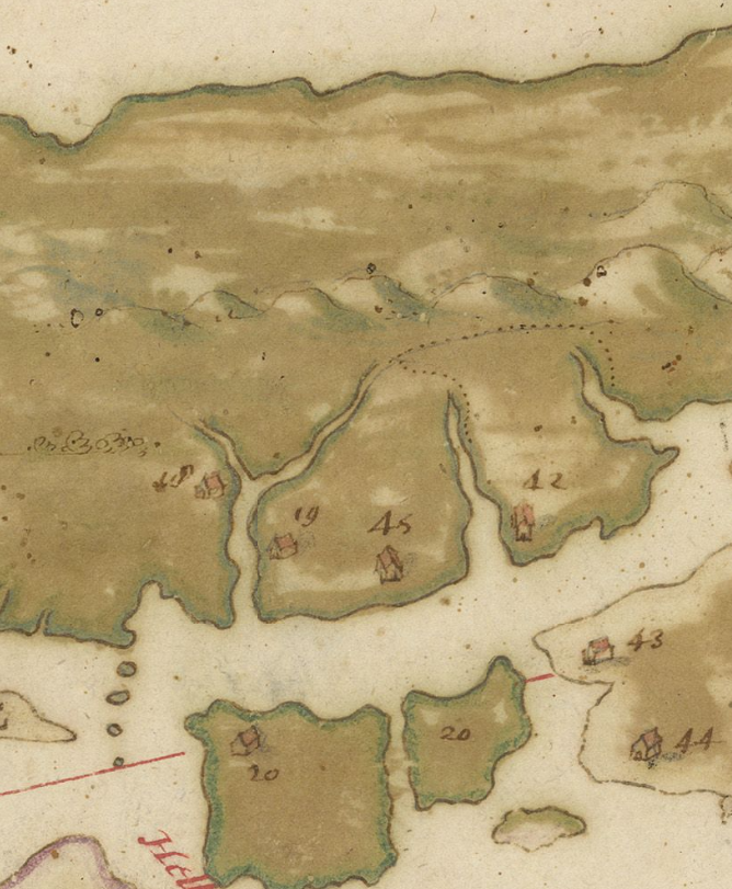
ABOVE: Costello Copy of the Manatus Map held by the Biblioteca Medicea Laurenziana. The homestead is No.18
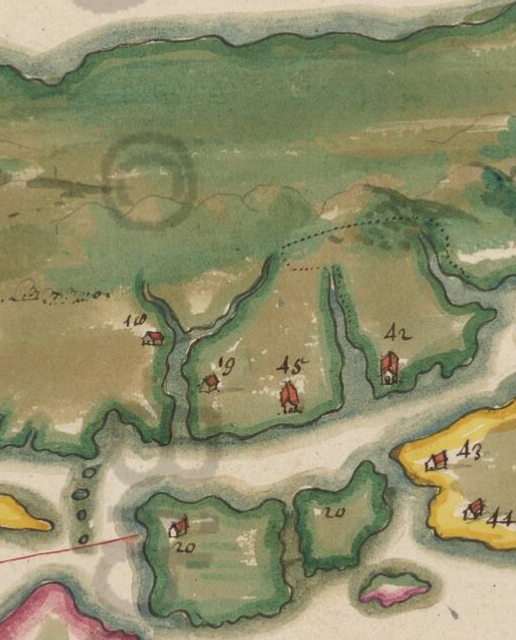
ABOVE: Vatican Library Copy of the Manatus Map. The homestead is No.18
To further examine the question as to the location of the homestead, we must explore the topography of the land. We must also examine in more detail what the prime requisites and concerns deForest and LaMontagne would have had when they chose a site. These would have included access to suitable fresh water, defense from possible attack by the Native Americans, easy access to the two tracts of Vredendael, and safety from the natural elements and disease.
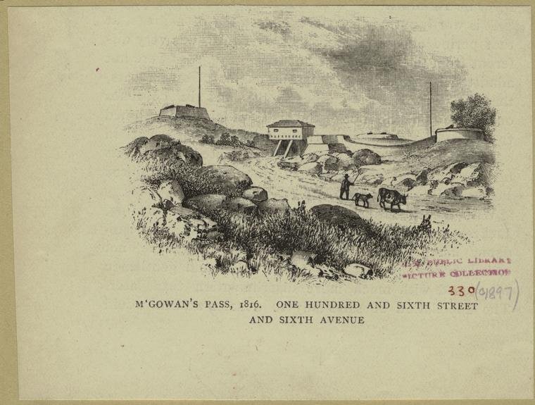
Essential for access to the two tracts of Vredendael was “McGown Pass”, named after an 18th-century property and tavern owner whose establishment overlooked this site. A historic gateway between lower Manhattan and the Plains of Harlem, the King’s Bridge Highway meandered its way between two steep hills, avoiding the swampland and impassable marshes that separated the two sections of Vredendael. Here is how Hall described the landscape, now part of Central Park, that gave the pass its importance: “When Manhattan Island was in its natural condition, a broad inlet called Harlem Creek made in directly westward from the Harlem River between 106th street and 108th street, its head extending up to the heights of Central Park just within the Fifth Avenue line. On the south side of the creek was an extensive and impassable marsh.”HALL p8
ABOVE: Modern day McGown’s Pass. BELOW: M’Gowan’s pass, 1816. One Hundred and Sixth Street and Sixth Avenue.
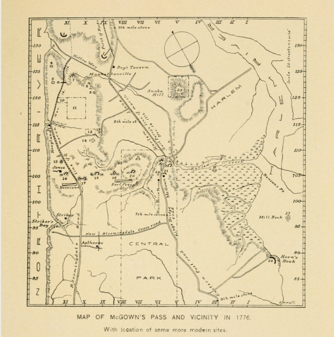
Map of McGown’s Pass and Vicinity in 1776.
In further illustrating the importance of McGown Pass in his description of the Old Post Road, Hall continued on as follows: “This old road ran up on the easterly side of Central Park, approximately along the line of 2d and 3d avenues, until it reached about 81st street and 3d avenue. Then, to avoid the swamps and inlets tributary to the East and Harlem Rivers, it bent sharply northwestward, entered Central Park at 92d street and Fifth avenue, and escaped the head of Harlem Creek by passing over the height on which now stands McGown’s Pass tavern.”HALL p9
These so-called impassable swamps and marshes in restricting access may have also provided protection against attack if strategically used. Evidence of such use of these natural barriers for defensive purposes can be found in LaMontagne’s own writings in a journal he kept from 1623 to 1625 while on an expedition to Guyana with plans of establishing a settlement. The following excerpt from that journal may prove relevant: “On Saturday the 23rd, we entered the River Scapome to visit the settlement of the Indians, who brought us 3 pigs, a rabbit, and a partridge. All pronounced the place good and convenient for forming a Colony; it is flat and uniform, raised 18 to 20 feet above the marshes which surround it, and at a distance of half a league from the River
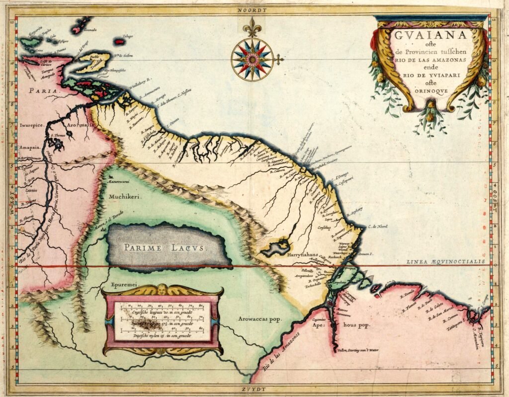
Emphasizing the importance of defense as a prerequisite for a settlement site are LaMontagne further comments on another site for a possible settlement: “…we descended to Apoterj point, where the river becomes so narrow that it is only 150 paces wide. The land is high, raised 12 or 15 feet above the water, having the river on both sides. We thought that if the families came, this place would be very suitable to fortify.”DE FOREST v2 p247
The previous clues give some indication of the location of the homestead, placing it in the vicinity of “the Point” if not on it, with the most likely location being in the vicinity of present-day 5th Avenue, between 105th and 106th Streets. The problem with this theory is the availablity of a fresh water supply.
There are three water sources that made their way through the two sections of Vredendael. The largest of these was Harlem Creek, which rose near the Hudson River in the Hollow Way of Manhattanville. Meandering on its way, it first helps to define the Northeast side of Montagne Flats; then, continuing on, it makes a sharp left turn that once helped to define the northern border of Montagne Point. The second waterway of Vredendael, once known as Montayne’s Fontaine, still contributes to the beauty of Central Park. It originated somewhere in the vicinity of 95th Street and 9th Avenue and entered Central Park at 101st Street and 8th Avenue. Continuing in a generally northeasterly direction to the intersection of the imaginary lines of 6th Avenue and 109th Street, it flowed around the base of the heights in the northeastern part of the park and emptied into Harlem Creek at 5th Avenue and 107th Street.HALL p8 The third creek, or rivulet, originating somewhere west of 8th avenue and 110th street, would merge with “Montagne’s Fonteyn” just before their confluence emptied into Harlem Creek.HALL p9
The Homestead Enclosure
Riker writes regarding the deForest/LaMontagne homestead enclosure: “Winter and spring had not passed in idleness, as is manifest from the amount of work which had been accomplished in clearing land and getting ready for the season of planting. A farmhouse was being built, in the Dutch rural style, having an ample ground floor, forty-two feet by eighteen wide, with two doors.’ The roof was thatched, and, as a protection against the Indians, the house was surrounded by a high, close fence of heavy round palisades or pickets. The inclosure (sic), which was entered by a well-secured gate or gates, was ample for out-buildings, including a house for curing tobacco.”RIKER p126
Historical Provenance of Vredendale
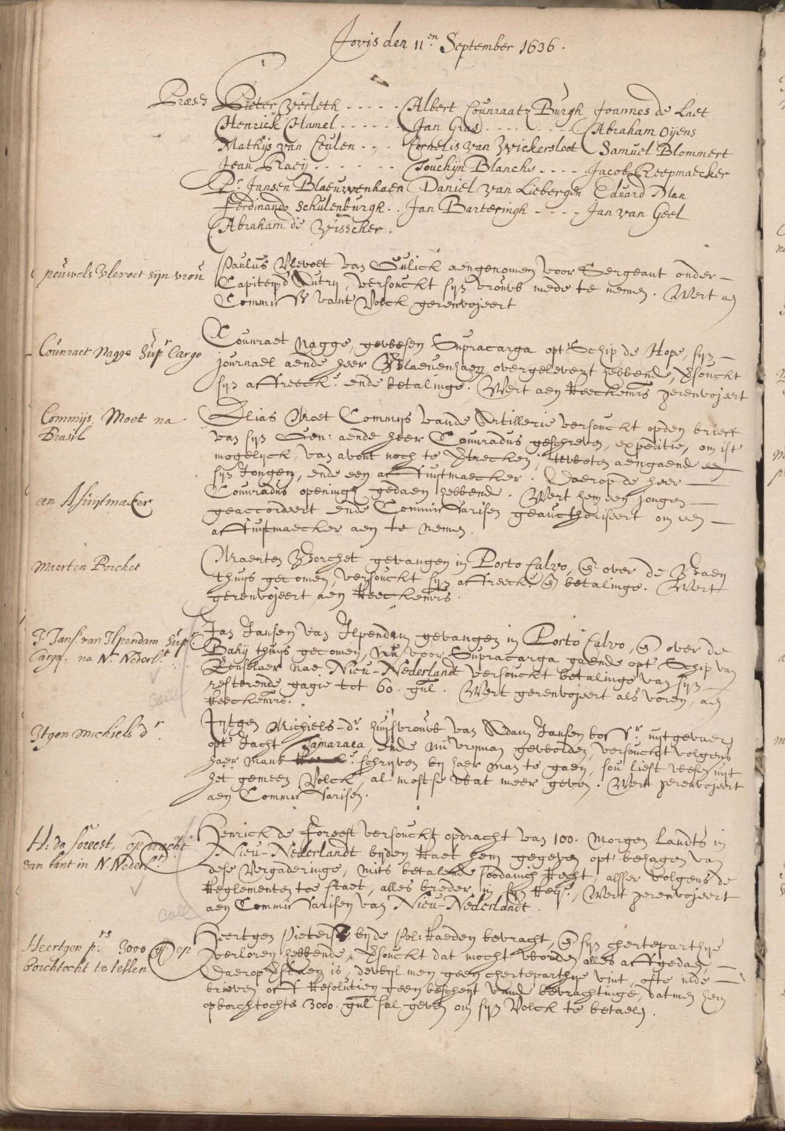
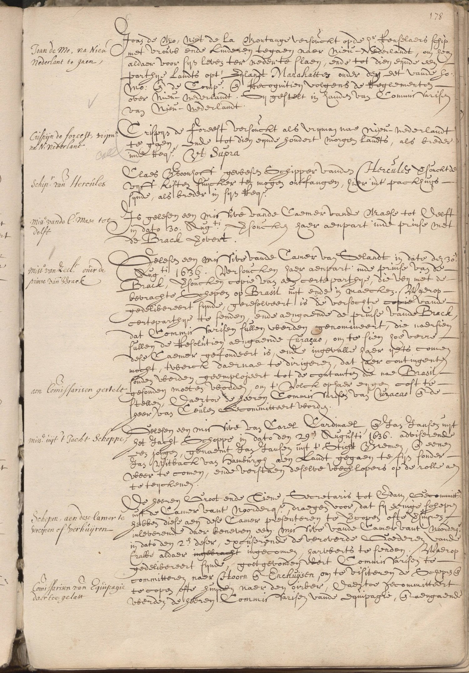
We can probably place the romantical conception date of Vredendael sometime in the summer of 1636. On July 1st of that year Hendrick de Forest and his cousin Crispen de Forest married sisters Geertruijt and Grietje Bonstra. On August 8th Killiaen van Resselaer and Gerad des Forest came to terms over their partnership in the ship Renselaerwyck. One month later, on September 11th allied members of the de Forest family appeared before the Amsterdam Chamber of the Dutch West India Company, each with separate petitions. 11 First was that presented by Hendrick de Forest, who requested one hundred morgen, or two hundred acres, in New Netherland.NNA p177b NYG&B 49 Next appeared Johannes LaMontagne, who stated that he planned to make passage on the ship Renselaerwyck with his family, requested land on the Island of Manhattan.NNA p178a NYG&B 49 Lastly, Crispin de Forest12 who, like his cousin, petitioned for 100 morgen of land in New Netherland.NNA p178a NYG&B 49 All three petitions were to be Referred to the Commissioners of New Netherland.
So it was that the ship Rinselaers Wijck (Rensselaerswyck), owned by patroon Kiliaen Van Rensselaer and Gerad des Forest, departed Amsterdam en route to New Netherland (New York). The ship set sail from the Texel on October 8th, 1636. Among those on board were La Montagne, his wife Rachel, their three children, Jesse, Jean and Rachel—daughter Marie would be born on the voyage off the island of Madera. Also on board were Isaac de Forest and his elder brother Hendrick, who was a mate on the ship, as well as Tobias Teunissen and Willem Fredericks Bont, both men indentured to Hendrick de Forest for the purpose of farming.VAN LAER 1908
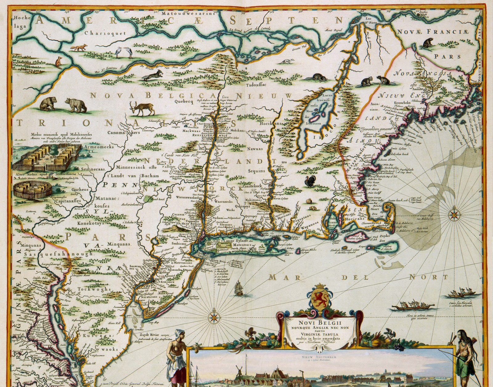
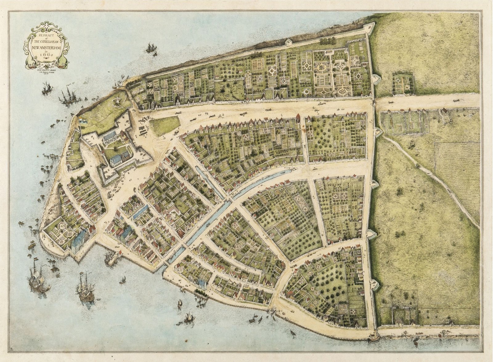
ABOVE: novi_belgii-novaeque_angilae_nec_non-parstis_virginiae_tabula…by Nicolas Visscher. BELOW: The “Costello Plan” of Fort Amsterdam, c1660.
It was a rough voyage, but finally on March 4th, 1637 the ship anchored at the tip of Manhattan Island. Hendrick de Forest, and his brother-in-law LaMontagne, set about selecting the farm they were to name Vredendael. De Forest must have relied heavily on his brother Isaac, sister Rachel, and LaMontagne. Though Vredendael was granted to him, de Forest was also occupied with his duties as a “mate” on the ship Renselaerwyck. On the 21st of March Hendrick was detailed to set up a warehouse on the Island of Manhattan, wherein the cargo of the Rensselaerwyck was to be sold. Less than a week later, the ship raised anchor and was now plying the Hudson River. Arriving back at Manhattan on June 12, it was less than a week later that the Renselaerwyck set off to ply the mid-Atlantic and only returned on July 16th. Ten days later, on July 26th, Hendick deForest was dead, of what cause we do not know. VAN LAER 1908
Having at this time15 spent less than three weeks total on the Island of Manhattan deForest in his absence had placed LaMontagne as overseer of Vredendael. LaMontagne, by his own account, began extending money to the maintenance of the farm on July 3rd, 1637 and by June 22nd, 1638 he had advanced the de Forest estate in total 1094 florins, with a net expenditure of 680 florins.DE FOREST 1900 p197-199 O’CALLAGHAN (1865), p4 Back in Holland, having received word of her husbands death, in early 1638 the widow deForest got engaged to Andries Hudde.Riker p129 It was through this engagement that on July 20th, 1638 Andries Hudde, having returned to New Netherland through petition, received a patent for Vredendael from Willem Kieft.16 Here the timeline gets a little muddled do to the distance and communication time between New Netherland and Amsterdam.
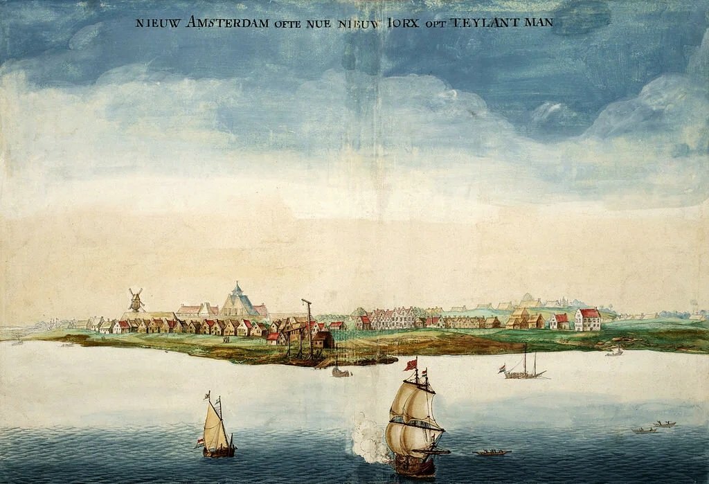
ABOVE: Fort Amsterdam. By Nicolas Visscher.
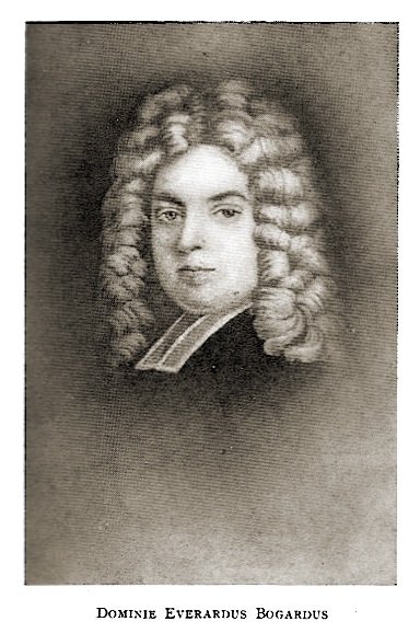
Unbeknownst to Hudde, who was now back in the Netherlands, was that in September of 1638, at New Amsterdam in a court proceeding before the Council, LaMontagne brought suit against Domine Bogardus, who held power of attorney for Geertrjt Bonstras, widow of the late Hendrick de Forest. The position of LaMontagne was that Bogardus should take possession of the de Forest house, along with the cattle and appurtenances of the plantation, provided La Montagne was paid the balance due him. The parties were then ordered to submit their complaint and answer in writing on the next court day. VAN LAER (1974), p23 At the end of September, in a reconvening of the Council, it was now decreed that the estate of Hendrick de Forest should be sold at public auction to the highest bidder. The auction was to take place on the following Thursday, and from those proceeds, “La Montaengnie” was to be paid all his advances on said estate. VAN LAER (1974) p25 O’CALLAGHAN (1865) p4, p375 And so it was on October 7th, 1638, at New Amsterdam that the farm Vredendael was put up for sale. Having made the highest bid, the estate of the late Hendrick de Forest went to Johannes La Montagne for 1700 guilders.RIKER 150 p17 The terms of the sale included a payment Schedule whereby the amount of money owed was to be paid in full over the course of one year. The first was to be a down payment, followed by the second payment six months later, and the third was to be made at the closing of the assigned period.
Word of the sale of the deForest estate had not reached the Netherlands for several months. Evidence of this is the Leiden notary document dated the 4th of January, 1639 wherein Jean de Forest on behalf of himself and his minor brother Isaac, both being heirs of their brother’s estate, by such notary document did authorized Jacob Bonasse of Amsterdam, along with Geertruyt van Bornstra widow of Hendrick de Forest, “…to settle, divide and distribute the property and estate of said Hendrick de Forest… whether in Amsterdam, Virginia,18 or elsewhere.”DE FOREST V2 p355 Two days later, on January 6th, Hudde and the widow deForest were married at Amsterdam.
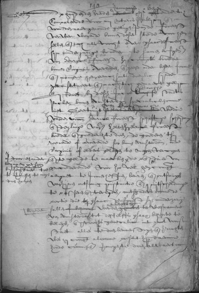
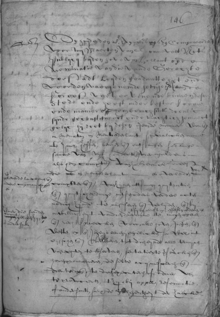
The sale of Vredendael still may have remained unknown to those in Amsterdam for a couple more months, as it was not until April of 1639 that Jean de Forest again appeared before a Leiden notary. This time, representing himself alone, he named LaMontagne of “Menatan in Neiunederlant” to be his power of attorney and to receive the sum of five hundred and four guilders. Here, Isaac, who remained in New Netherlands, was not named in this notary document as he had been in the prior document.17 It would seem that word of the purchase of Vredendael by LaMontagne had not reached the Netherlands until sometime between January and April of 1639.
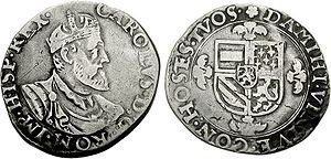
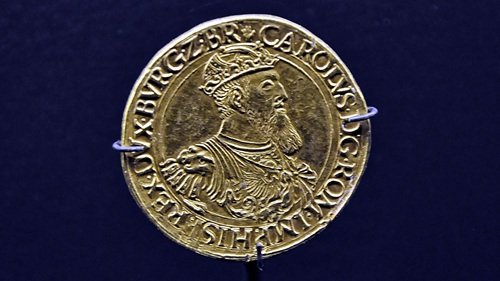
Having only partially financed the purchase of Vredendael, LaMontagne made a payment to Hudde for two hundred “carolus guilders” on July 18th, 1639.O’CALLAGHAN (1865), p9 However, the final payment was not made to Hudde until the 28th of August, 1640, as it was recorded in the register of the Provincial Secretary that both parties had amicably come to terms.GEHRING (1638) p196 O’CALLAGHAN (1865) p14 DE FOREST (1900) p199 Protecting his wife’s interest, Hudde had Montagne submit a document to the Provincial Secretary dated 11th of August, 1640, stating that LaMontagne was responsible to satisfy Isaac and Jean deForest for their share, that being a sixth part, in their brother Hendrick’s estate.
Perhaps it was the ongoing war between the Native Americans and the colonists that caused LaMontagne to give up farming and lease Vredendael, or maybe it was the illness of his wife, Rachel, who would die within the next couple of years. Nonetheless, on June 14th, 1643, LaMontagne signed a lease for the farm Vredendael to Bont Francen for a term of three years, upon the expiration of which the lessee was to return the farm in the same condition as he had received it. This would include the orchard, tools, livestock, etc. And he was to have planted the same amount of crops as had been planted by LaMontagne earlier that spring. Francen did not stay long on Vredendael, but probably due to ongoing hostilities with the Native Americans, he was forced to give up the lease on September 27th. In fact, contemporary sources say that “Montagne was driven off his land” and lost everything that he was not able to take with him, as nearly all the farms on Manhattan were abandoned. JAMESON (13) p338 FERNOW (1883) p47
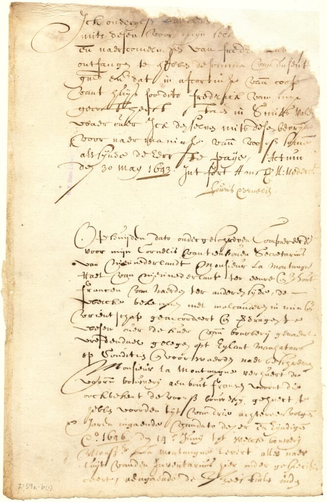
New York State Archives. New York (Colony). Secretary of the Province. Register of the Provincial Secretary, 1642-1660. Series A0270-78. Volume 2, document 59a – 59b.
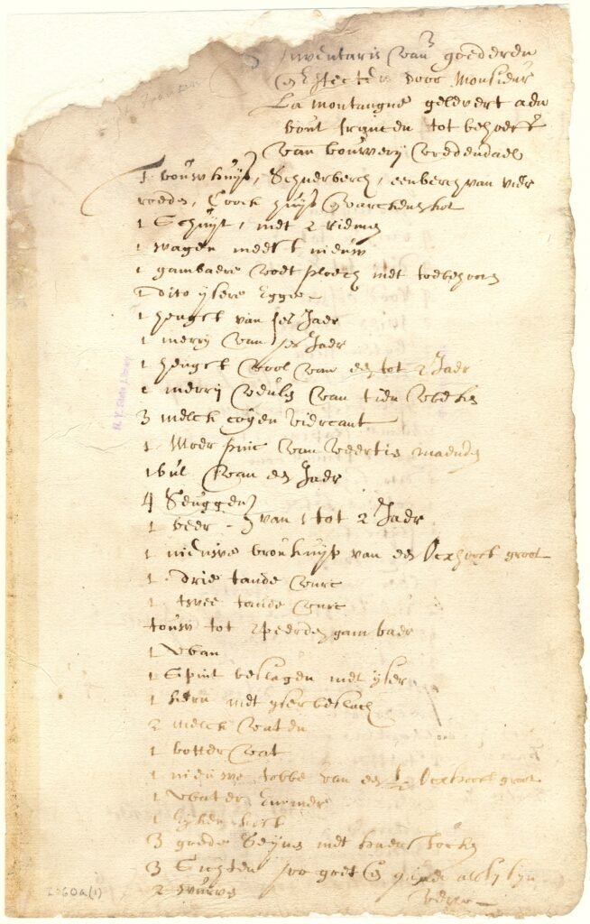
New York State Archives. New York (Colony). Secretary of the Province. Register of the Provincial Secretary, 1642-1660. Series A0270-78. Volume 2, document 60a.
Whether or not LaMontagne ever returned to the land, or leased it out, we suspect that he did not. The next time we hear of Vredendael is the confirmatory patent for the farm that LaMontagne obtained from William Kieft on May 9th, 1647. Here is how Vredendael was described in that document: “100 morgens of land on Manhattan Island, situated in the flat between the hills and kill and a point stretching between two kills called Rechgawanes to the east River, land that had belonged to the estate of the late Hendrick Foreest, and was purchased by Mr. la Montagne at public auction for 1700 guilders.” RIKER p150 DE FOREST (1900) p200 O’CALLAGHAN (1865) p375
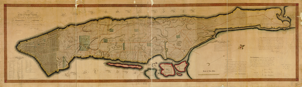
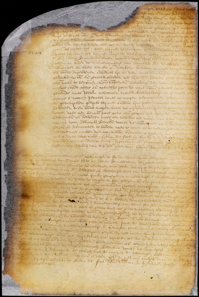
New York State Archives. New Netherland. Council. Dutch colonial patents and deeds, 1630-1664. Series A1880. Volume GG.
Two months later, on July 6th, 1647, at New Amsterdam, all the farmers who had cultivated their lands for more than ten years were summoned to appear before the council at Fort Amsterdam and were informed that they were liable to pay the West India Company the tenth of their crops. The farmers acknowledged that their grace period had expired and were obliged to pay the tenth, but whereas they had suffered great damage on their lands and otherwise in consequence of the war, they asked that they might be spared payment for an additional year. Taking the aforementioned into consideration, and that the people had only recently returned to their lands, the director-general and council deemed it necessary and advisable to release the farmers for this year from the tithes. VAN LAER (1974) p393
The next time we hear of Vredendael is from a petition dated July 4th, 1661. As the farm, “still owned by Dr. Montagne, had lain for some years unused, except as cattle and goats browsed in its deserted clearings and woodlands,” the Montagne family, namely Jan de La Montagne Jr., his brother William, and their brother-in-law Jacob Kip, now proposed to occupy it, and in this cause petitioned the Director and Council.RIKER p181 STOKES v4 p212 The petition was denied on the grounds that a new settlement in the vicinity of Harlem would retard the growth and development of that village.
With the influx of new immigrants came the demand for land to farm in the vicinity of New Amsterdam. Hence, on September 15th, 1661, the Director and Council issued a decree “directing all those holding claim to cultivated and uncultivated lands, commanded them to have those lands surveyed, and apply for and obtain a Patent as proof of property, on pain of being deprived of such property. In keeping with the intent to free up land for further distribution, it was soon decided that, “discarding the former ground-briefs, Van Keulen’s Hook and Montagne’s Flat were to be laid off into lots and distributed among the freeholders. It was agreed that Jan La Montagne (junior) should hold the Point, as having belonged to his father, and take full allotment there… and as a special immunity, should enjoy the Point free from any future demands in the way of town tax. He was to conform to the town (New Harlem) regulation against building upon the bouwlots, and was not to build or live upon the Point till the town saw fit to allow it”RIKER 185
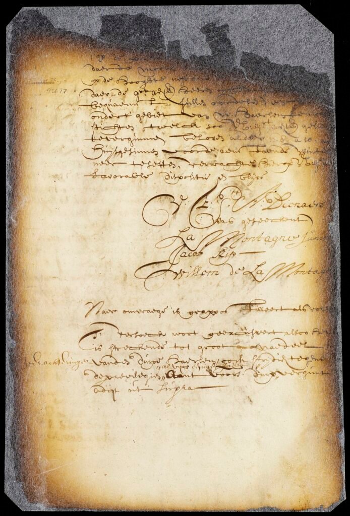
New York State Archives. New Netherland. Council. Dutch colonial council minutes, 1638-1665. Series A1809. Volume 9
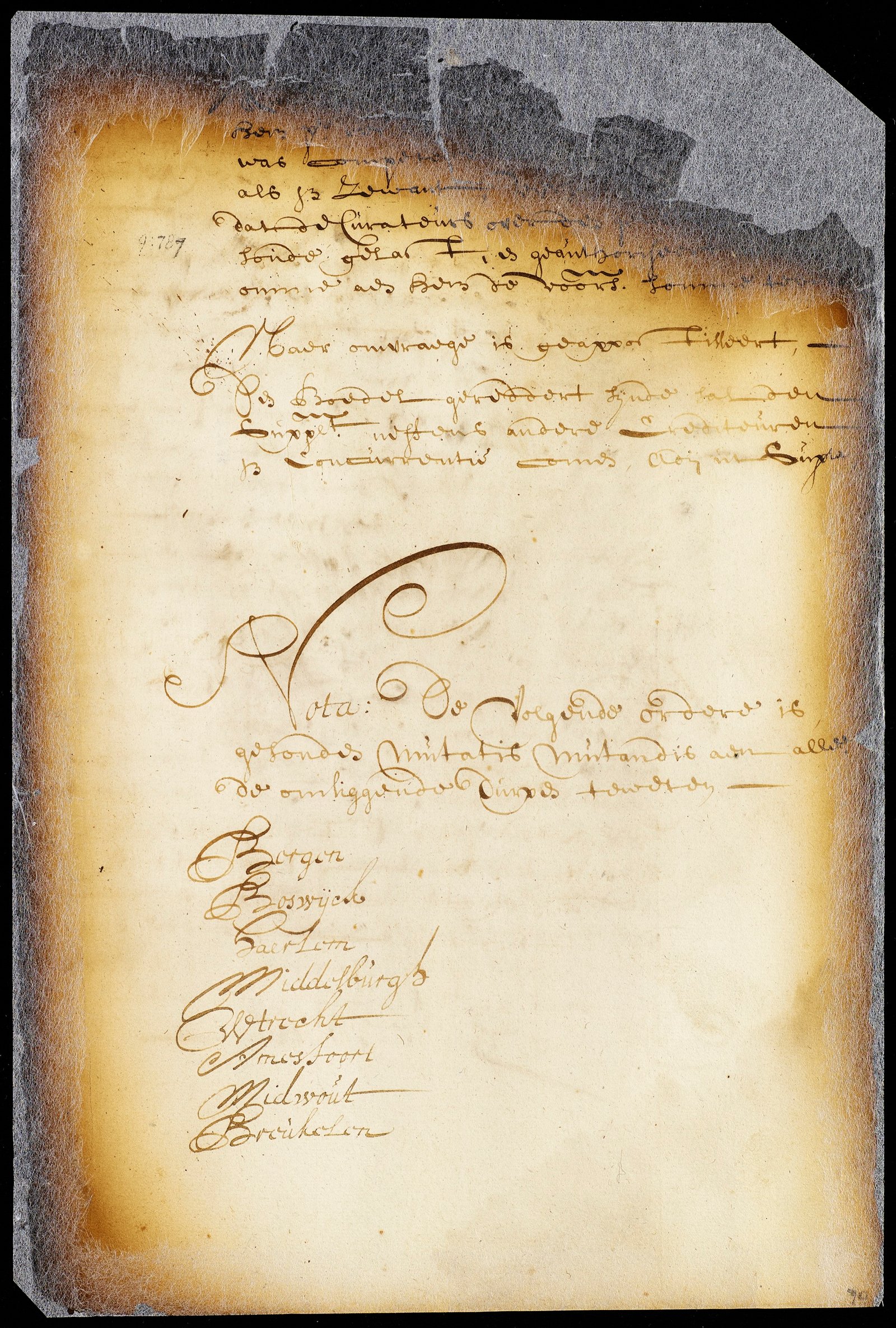
New York State Archives. New Netherland. Council. Dutch colonial council minutes, 1638-1665. Series A1809. Volume 9
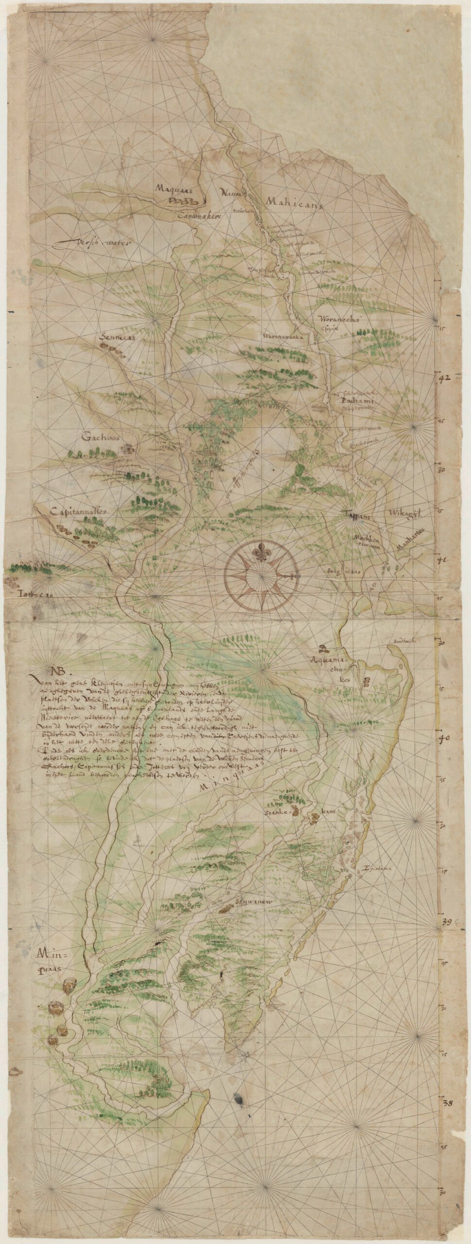
Riker claims that when Montagne Flats was taken away from the Montagne family, it was to help satisfy the debt owed to the company by the Senior LaMontagne. So that now all that was left of Vredendael was the point known as Rechcowanis, assessed at 32 acres. When the English gained control of New Netherlands in 1664, Jan LaMontagne Jr., so disaffected by the change in government20 contracted with partners Jan Myndertsen and Johannes Smedes, for his “piece of land, and meadow belonging thereunto, called by the name of Montagne’s Point, paled in betwixt two creeks, according as the bill of sale doth mention,” for 800 guilders wampum, to be paid by instalments.RIKER p212 For some unknown reason, the sale was never finalized and the point remained in the hands of Jan LaMontagne Jr.
On August 20th, 1669, Jan de la Montagne received a confirmatory conveyance from a group of the Wickquaskeek Tribe of Tappan Indians for land previously granted to his father, Doctor LaMontagne. The Native Americans who put their mark to this conveyance were Rechkewackan, Achwaaroewes, Sacharoch, Pasachkeegine, Niepenohau, Kouhamweu, and Kottareu. TUTTLE 267 RIKER 257 STOKES v4, 272
It appears that the conveyance was not immediately recorded, as on March 6, 1673, the town of Harlem assessed Jan LaMontagne Jr. for 18 morgen.RIKER p289 With the death of her husband Jan, it was left to Marie Vermilye to complete the sale of the point. On March 30, 1674 Maria appeared before Jan Vandervin, Secretary of the Town of New Harlem and signed a confirmatory deed acknowledging that her husband during his lifetime had sold to Jan Louwe van Schoonderwort his piece of land called Montainje’s Point, together with the meadow referred to in the deed of May 18, 1671, and by resolution of 8 February, 1672. NYCD lib226 p37 TUTTLE p269 RIKER p281
On May 18th, 1671, Jan LaMontagne sold to Jan Louwe Van Schoonrewoerd [later known as Jan Louwe Bogert] the “piece of land named in the Dutch language Montagne’s Punt, or by the Indians Rechcowanis,” for the sum of 3,000 Gilders. LaMontagne reserved “the crop of grain, the hop plants, apple and pear trees, and twelve cherry trees.”21 Full possession was to be given on receipt of the first payment, due May 1st, 1672. RIKER 294 Perhaps as a stipulation of the sale LaMontagne was to have his possession of the point confirmed. For on the 8th of February, 1672 at New Harlem the magistrates of the village by resolution deeded to Jan de La Montagne “a piece of land together with the annexed meadows, named Montagne’s Point, formerly owned by his late father, lying within the jurisdiction of this Town, bounded on the North side by a creek, named Montagne’s kil, stretching from the East River to a fresh water creek, stretching between Montagne’s flats and the aforesaid point, on the South side bounded by a creek and a meadow and by the hills to the aforesaid fresh water creek where the King’s Highway crosses it; with the meadows lying in the bend of Hellgat, which the aforesaid Montagne has exchanged for the Town’s meadow lot…” TUTTLE p268 RIKER p279
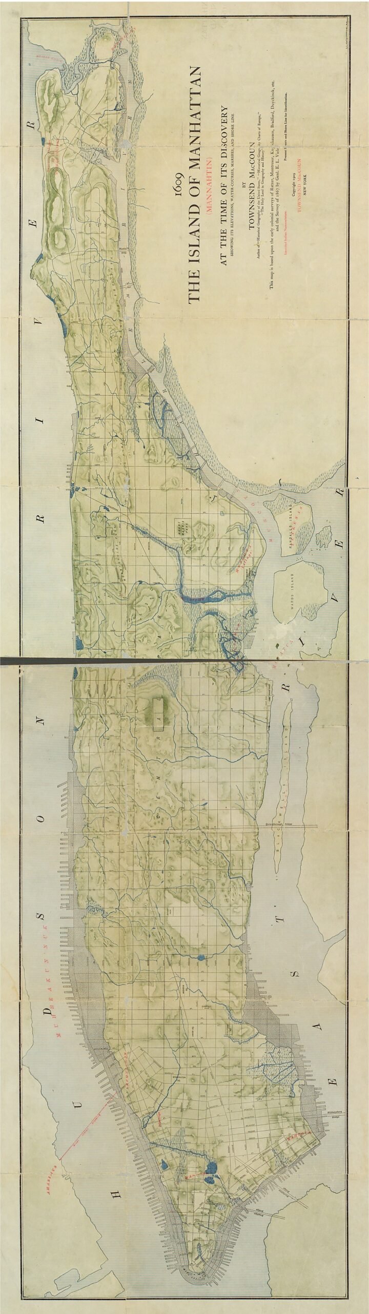
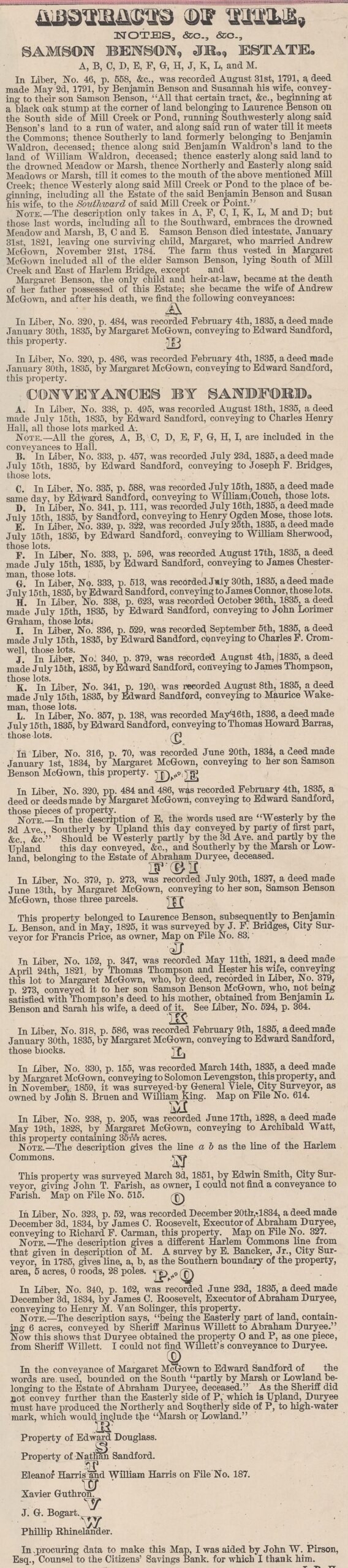
It was some twenty years later that the Point was again named in deed. In 1706 “John L. Bogert” sold the point to Johannes Benson, though the deed wasn’t recorded until 1827. This deed seems to add to the mystery and confusion around Konaade Kongh, which was given as a demarcation in the confirmatory deed with the Wickquaskeek. In the recorded copy of the Benson deed Konaade Kongh was not mentioned, but in the western demarcation, the King’s Highway was named. This brings us back to what Riker wrote of Konaade Kongh, among which was the following: “An Indian term which occurs in a Dutch document of 1669, but misread, apparently, by the late Dominie Westbrook,15 who rendered it King’s Highway, the proper Dutch for which is Koning’s Hooge Weg.” It’s possible that these are two separate boundary points. Konaade Kongh may have been the original boundary of the Point when Dr. LaMontagne received his confirmatory patent for Vredendael. Whereas the “King’s Highway” was the boundary set by the town of Harlem when they conveyed 32 Acres on the point to LaMontagne.
Bogert, having sold the point to Johannes Benson in 1706, the point remained in the hands of the Benson family through the next several generations, first to Samson Benson, then to his son Benjamin, and then to his grandson Sampson Benson. Sampson Benson the younger died intestate in 1821 and his holdings fell to his daughter Margaret Benson who by then had married ship’s Captain Andrew McGown. After the loss of the captain at sea Margaret and her and her son Sampson Benson McGown continued proprietory of McGown’s tavern. The widow McGown finally sold nearly all her her holdings in vacinity of McGown Pass and the “Benson’s Point” to Edward Sanford in 1835. From there most of the properties were broken up and sold.
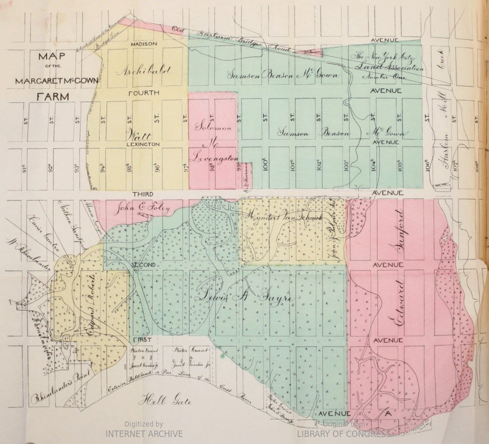
New York County Deed Liber 226 page 37 (Orig p.14)
“Recorded for and at the request of Andw McGown this 21st day of September 1827… This Indenture made the twenty first day of September… one thousand seven hundred and six Bewteen John Laurensen Bogart of Harlem on New York Island Yeoman and Cornelia his wife of the onee part and Johannes Bensen of the Bowery within the Limitts of the City of New York yeoman of the other part. Whereas John De Lamontaine late of Harlem aforesaid yeoman deceased by an Instrument of sale bearing date the 18th day of May Ano. Din 1671 for the consideration therein mentioned did bargaine and sell unto the said John Lowssen Bogart a certain parcell of Land and Meadows commonly called Montaines Point and by the Indians or Natives of the Countrey called Rechcowanis the said Land and Meadow being bounded on the North side with a Kill of Creek commonly called Montaines Kill stretching from the East river to a certain ffresh run of kill running betwixt Montaines plaine and the aforesaid point bounded on the South with a run or kill and a Meadow and with the hills till it meets with the aforesaid ffresh run or kill over which runs the King’s highway Together with the Meadow lying in the Bay of Hellgate which the said Montaine exchanged for a Townes lot of Meadow and whereas it so pleased God that the said John De Lamontaine came to die before all the conditions in the said bill of sale were due to be performed And Whereas afterwards the said John Lowesen Bogart paid the remainder of the consideration all money in said Instrument of sale mentioned to Marie the Widdow and relect the said John De La Montaine she the said Maria by a certain deed or instrument in writing under her hand bearing date the thirtieth day of March Ano Din 1674 did confirme transport and make over to him the said John Lowesen Bogart all the above recited premises as by the said Instrument… AND WHEREAS the said Maria Widdow of the said John De La Montaine by her certain bill of sale beareing date the fourth day of November Ano Din 1679 for the consideration therein mentioned did grant bargaine and sell the said Cornelia the wife of the said John Lowesen Bogart being authorized by her said husband to purchase a certain hopp Garden lying at the reare of the land heretofore granted to the said John Lowesen Bogert by the said John De La Montaine and Maria his wife betwixt said land and the hill thereto adjoining with all the right and title thereto belonging… ALL that a certain parcell of land lying in the bought of Hellgate beginning on the Southwest corner of the Hopp Garden by a berkenboone or burtch tree running to the white oake tree which stands by a small Swamp markt with the letters J.L.B. and the letters J.L.D. towards the river running by a rock markt J.L.B. and J.D.L. and running towards the strand or Riverside to the end of a Meadow on the North of a stoney or ________(?) hill as it was then a is now known by the name of the lot No. 4S and which joynes to the South side of the above mentioned lands and meadows of him the said John Lowesen Bogertt… Now this Indenture Witnesseth at the said John Lowesen Bogert and Cornelia his wife for and in consideration of the sum of Six hundred and fifty pounds currant money of New York to them well and truly in hand paid by the said Johannes Bensen…
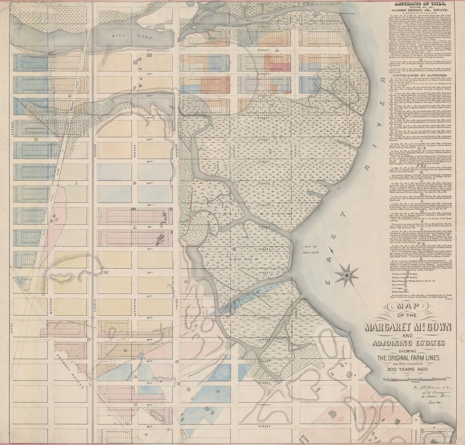
Above, Tidal Map of Vredendael. [Note that Mount Moriis Square, AKA Marcus Garvey Park, is 20 acres.]
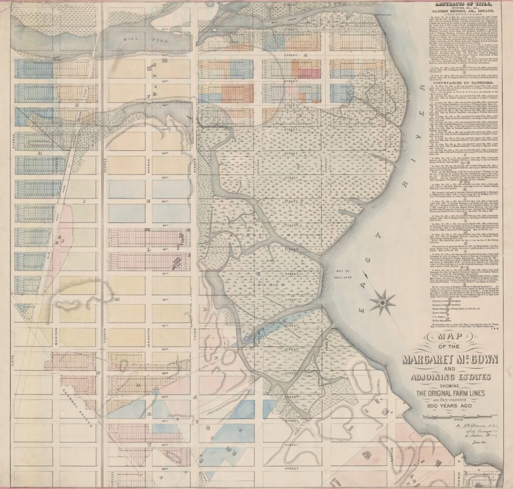
From Ledger on the above Map… “In Liber, No. 46, p. 558, &c., was recorded August 31st 1791, a deed made May 2d, 1791, by Benjamine Benson and Susannah his wife, conveying to their son Samuel Benson, ‘All that certain tract, &c., begenning at a black oak stump at the corner of land belonging to Laurence Benson on the South side of Mill Creek or Pond, running Southwesterly along said Benson’s land to a run of water, and along said run of water till it meets the Commons; thence Southerly to land formerly belonging to Benjamin Waldron, deceased; thence along said Benjamin Waldron’s land to the land of William Waldron, deceased; thence easterly along said land to the drowned Meadow or Marsh, thence Northerly and Easterly along said Meadows or Marsh till it comes to the mouth of the above mentioned Mill Creek thence Westerly along said Mill Creek or Pond to the Place of Beginning, including all the Estate of the said Benjamin Benson and Susan his wife, to the Southward of the said Mill Creek or Point.'”— See Map Ledger for additional deeds.

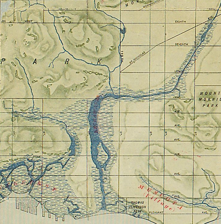
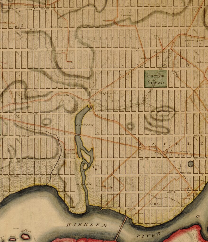
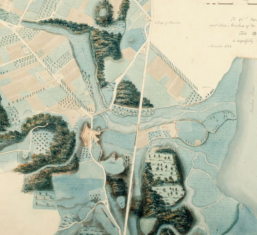
1807 Manhattan, Vredendael.
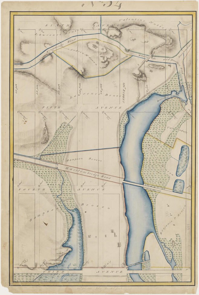
1818, Randel’s Farm Map.
“When Manhattan Island was in its natural condition, a broad inlet called Harlem Creek made in directly west- ward from the Harlem River between 106th street and 108th
street,* its head extending up to the heights of Central Park just within the Fifth avenue line. On the south side of the creek was an extensive and impassable marsh. The creek
received the waters of three rivulets, the largest of which rose near the Hudson River in the Hollow Way of Manhattanville. Another, which still in part contributes to the beauty of Central Park, originated somewhere in the vicinity of 95th street and 9th avenue and entered Central Park at l01st street and 8th avenue. Continuing in a generally northeasterly direction to the intersection of the imaginary lines of 6th avenue and 109th street, it flowed around the base of the heights in the northeastern part of the park and emptied into Harlem Creek at 5th avenue and 107th street.” [Hall, p8]
“The sharp westward bend of the King’s Bridge Road which carried it over McGown’s Hill was for the purpose of passing the head of Harlem Creek and marsh which extended up to its base. The ” Pass ” may have meant the place where this notable and inconvenient obstacle was passed.” [Hall, p16]
ABOVE: 1905 map of Central Park above 102nd Street, with outline of 1814 fortifications.
NOTES
- “The Indians about here,” says Capt. David De Vries, who had been a great
deal among the Wickquaskeeks and other tribes living around New Amsterdam, “are
tolerably stout, have black hair, with a long lock which they let hang on one side of
the head. The hair is shorn on the top of the head like a cock’s comb. Their clothing
is a coat of beaver skins over the body, with the fur inside in winter and outside in
summer; they have also sometimes a b’ear’s skin, or a coat made of the furs of wild
cats or raccoons. They also wear coats of turkey feathers, which they know how to
put together; but since our Netherlanders have traded here, they barter their beavers
for duffels-cloth, which they find more suitable than the beavers, and better for the
rain. Their pride is to paint their faces hideously with red or black lead, so that
they look like fiends. Then are they valiant; yea, they say they are Manetto,—the
devil himself.” [Riker, fn, p127] ↩︎ - This is a story that seems to many to be a foolish act on behalf of the Native Americans for allowing themselves to be cheated. However, who is to say which side got cheated? For if you consider the matter further… How and when was that twenty-four dollars calculated, and what value would it be today? Beads had been traded all over the world for centuries. How much did the Native Americans get for those same beads when they traded with other tribes? Remember that the main currency of the Dutch colony of New Netherland was not the guilder but wampum, which was basically beads made from snail shells. It is also believed that the Native Americans who sold Manhattan only held claim to the bottom portion of the Island. When they made the sale, they likely believed that they still held rights to hunt and fish on the land. Lastly, if someone was looking for those who made foolish bargains, one of the best examples in history can be found in the Dutch tulip mania of the 1630s. ↩︎
- Today known more as Montayne’s Rivulet”, in deeds of old it was referred to as a “fonteyn”, or spring. In this case, meaning spring, and the stream that flows from it. This stream or rivelet became a recognized boundary, and is several times referred to in connection with this and the adjoining property, and always, in the original, called the fonteyn.RIKER p258 Here, Riker describes it as it was found in his day “… Montagne’s Spring.—Perennially flowing, as in the virgin days of the settlement, this spring is still to be found in Central Park. Its source is on a hillside, at a point (where the ways mentioned extended into the Park) on the line of 105th Street, some 200 feet west of Sixth Avenue. But this natural basin is now covered over, the water being led by a subterranean conduit to the foot of the hill, where, in a secluded, romantic nook in the rocks, it again leaps forth as playfully as of old, when it was known among the Dutch inhabitants as the “fonteyn; ” whence, in following its ancient outlet or run, it is soon lost in the modern Harlem Lake. Should it not be called Montagne’s Spring? RIKER p182fn Stokes, with no other given source than Riker, gives the following: “The stream, or fonteyn, as the Dutch called it, ‘behind’ the point, was the boundary stream which the Manatus Maps show between the Flats and the Point. Here, at Konaande Kongh, Hendrick de Forest built his house; but before it was quite finished, he died…”STOKES 1922 p194 Stokes, again with only Riker as his source, goes on to say: “The house of De Forest, later Montagne’s, stood on the high ground near McGowan’s Pass, now in Central Park, which site was fortified during the War of 1812. Its approximate location was west of Fifth Avenue at 107th Street. The fonteyn still feeds the Park Lake.STOKES 1922 p194 In a sparate volume stoke gives the following regarding the “fonteyn”: The northern boundary of the tract was at about 124th Street, while on the south it included the high land in Central Park at about 109th Street. Near this latter boundary was a copious spring, or, as the Dutch called it, ‘fonteyn,’ which still flows almost as it did then, a rippling brook with little waterfalls, until it empties into Harlem Mere in the northern part of the park.STOKES 1922 p950 ↩︎
- Note: the following may well be referring to Native Americans on the point of . “Lucky, too, was he if his first welcome was not conveyed by the swift-winged arrow from behind the thicket, as was the case with Captain Dermer, ten years after Hudson’s visit, but before the Dutch had yet occupied Manhattan Island. Coming from the eastward, and passing a most dangerous cataract among small, rocky islands,” he soon found greater perils than those of Hellgate in the hostility of the natives: for, says he, ‘the savages had great advantage of us, in a strait not above a bow-shot, and where a multitude of Indians let fly at us from the bank ; but it pleased God to make us victors.’ Only escaping, as his words seem to imply, and as had Hudson, by making his assailants feel the superiority of firearms, it seems hardly credible that such was ever the rude and perilous state of our beautiful Island, the now secure abode of peace and refinement.”[Riker, page 116] ↩︎
- An Indian term which occurs in a Dutch document of 1669 (see under that
year), but misread. apparently, by the late Dominie (Cornelius D.) Westbrook, who rendered it King’s Highway, the proper Dutch for which is Koning’s Hooge Weg. It may come from ko, a fall or cascade, and ononda, a hill; kong signifying elevated place or locality. Hence probably refers to the spring aforesaid, but possibly to a village site (an Indian village, or perhaps the one contemplated in 1661), nunda being the term for village. It approaches in sound nearly to the Iroquois Genunda, or Kannata, Village on the Hill, and from which, says Charlevoux, the name Canada is derived.[Riker, fn, p122] ↩︎ - Hellgate, or Hellegat, as the name was given by the Dutch, after an inlet of the West Scheldt, lies in full view at our right, the terror of ancient voyagers, and ·whose conception of it is well given in these words of an early writer: “Being a narrow passage, there runneth a violent stream both upon flood and ebb, and in the middle lieth some islands of rocks, ·which the current sets so violently upon that it threatens present shipwreck; and upon the flood is a large whirlpool, which continually sends forth
a hideous roaring, enough to affright a stranger from passing further, and to await for some Charon to conduct him through.”[Riker, p122] ↩︎ - ‘Jean (Johannes) de la Montagne receives from the Indians a confirmatory deed for “the Point named Rechawanis, bounded between a stream which runs to Montagne’s Flat; with the meadows from the bend of the Hellegat to Konaande Kongh.”—Harlem Recs. (MS. translation), II: 80, in possession of N. Y. Public Library; Riker, Hist of Harlem, 209, 287-88. The projection long known as Montagne’s Point, later called Benson’s Point, lay between the present 98th and 107th Sts., approximately, and extended from about the line of Fifth Ave. to the Harlem River.’STOKES 1922 p272 ↩︎
- There is no other reference to Konaande Kongh other that in this deed. ↩︎
- Riker, who does not address the location of Konaande Kongh himself RIKER 1904 p122, p257-258 does give his theory on the derivation of the placename which is as follows: “An Indian term which occurs in a Dutch document of 1669 (see under that year) , but misread, apparently, by the late Dominie Westbrook, who rendered it King’s Highway, the proper Dutch for which is Koning’s Hooge Weg. It may come from ko, a fall or cascade, and ononda, a hill; kong signifying elevated place or locality. Hence probably refers to the spring aforesaid, but possibly to a village site (an Indian village, or perhaps the one contemplated in 1661) , nunda being the term for village. It approaches in sound nearly to the Iroquois Genunda, or Kannata, Village on the Hill, and from which, says Charlevoux, the name Canada is derived. ↩︎
- Pierre-Francois-Xavier de Charlevoix. Histoire et description generale de la Nouvelle France… chez la veuve Ganeau, Paris (1744). ↩︎
- I have been unable to locate the original 1669 document that mentions “Konaade Kongh”. The next step would be to vist the Special Collections at the NYPL to examine the papers of James Riker. ↩︎
- “In reading some time ago one of the Gospels, (I think St. Mark’s,) in one of the Iroquois dialects, said to be translated by the celebrated chief Captain Brandt, I observed that the word town was translated into Indian by the word Kanada, and it struck me that the name of the province of Canada might probably have been derived from it. I have not been able to procure the book since, but I have now before me a translation of the English common prayer-book into the Mohawk, ascribed to the same chief, in which I find these words: ‘Ne Kanada-gongh konwayatsk Nazareth,’ which are the translation of ‘in a City called Nazareth,’ (Matth. ii. 23.) The termination gongh in this word appears evidently to be a grammatical form or inflexion, and Kanada is the word which answers for ‘city.’ I should be glad to know your opinion of this etymology. HECKEWELDER p421-422 ↩︎
- A few weeks earlier a one Jan de Forest appeared before the Amsterdam Chamber of the west India Company and notified them of his plans to travel to Brasil. Whether or not if this was the son, or perhaps the brother of Jesse de Forest, is unknown. ↩︎
- Crispin de Forest ↩︎
- It’s almost certain that deForest has previously been at Island of Manhattan. ↩︎
- This was the first patent granted for land at Harlem, and perhaps the first patent for land on the Island of Manhattan. ↩︎
- The conditions of the sale included a payment schedule. The first of three payments was made upon the closing of the auction. ↩︎
- “Virginia” was a generic name applied to much of the east coast of North America between Maine and Florida. ↩︎
- Isaac de Forest was named in the first notary document as being a minor and Jan was his legal gaurdian. However, Isaac was not mentioned in the second document which make one wonder withing that short span of time, Isaac may have reached maturity. ↩︎
- Though Jean Sr. and his son William LaMontagne did sign an oath of alligience to the new government, Jan Jr. refused to do so.RIKER p211-212 ↩︎
- There is a cherry tree mentioned as a boundary in a mortgage dated May 3rd, 1757 between Daniel McGown and Benjamin Benson for property first awarded by drawing (1712) to Samuel Waldron for a tract that was origially lot number seven. This was land that included McGown Pass ect.STOKES 1918 p554-555 ↩︎
SOURCES
AKRF INC—Report prepared by AKRF Inc.’440 Park Avenue South, New York, New York 10016. Supplemental Archaeological Assessment Second Avenue Subway: 96th Street Station New York, New York. Prepared for: MTA New York City Transit.
ASSEMBLY—Documents of the Assembly of the State of New York. One Hundred and thirty-fourth session 1911. Vol. XXIX. Nos 55-58, inclusive. J.B. Lyon Company, State Printers, Albany (1911).
BOLTON 1904—Reginald Pelham Bolton. The Amerindians of the Upper Part of the Island of Manhattan. Tenth Annual Report, 1905, of the American Scenic and Historic Preservation Society. Brandow Publishing Company, Albany, New York.
BOLTON 1909—Reginald Pelham Bolton. The Indians of Washington Heights. “Anthropological Papers of the American Museum of Natural History”, volume 3. Hudson -Fulton Publication, New York (1909).
BOLTON 1922—Reginald Pelham Bolton. Indian Paths in the Great Metropolis
Part 1. Museum of the American Indian, Heye foundation, New York (1922).
BURROWS—Edwin G. Burrows. Gotham, A History of New York City to 1898. Oxford University Press (1999).
DE FOREST v1—Mrs. Robert W. De Forest [AKA Emily Johnston ]. A Walloon Family in America, Lookwood de Forest and His Forbears, 1500-1848, volume I, “Together with a Voyage to Guiana Being the Journal of Jesse de Forest and his colonists 1623-1625.” Boston and New York Published by Houghtom Mifflin Company (1914). [LCCN 14022574] Another Copy
DE FOREST v2—Emily Johnston De Forest [AKA Mrs. Robert]. A Walloon Family in America, Lookwood de Forest and His Forbears, 1500-1848, volume II, “Together with a Voyage to Guiana Being the Journal of Jesse de Forest and his colonists 1623-1625.” Boston and New York Published by Houghtom Mifflin Company (1914). [LCCN 14022574] Another Copy
DE FOREST 1900—J.W. De Forest. The De Forests of Avesnes (and of New Netherland) a Huguenot Thread in American Colonial History. New Haven, Connecticut; The Tuttle, Morehouse & Taylor Co., Printers and Publishers (1900). [LCCN 01030269] Another Copy
FERNOW (1883)—B. Fernow and E. B. Callaghan. Documents relating to the colonial history of the State of New York, Volume XIV: Documents relating to the history of the early colonial settlements pricipally on Long Island. Albany, N.Y.: Weed, Parsons and Company (1883). Series includes 15 vols (1856-1887). [LCCN 01022114] Another Copy
GEHRING (1638)—Charles T. Gehring. Register of the Provincial Secretary, 1638–1642. Translated by E.B. O’Callaghan; Improved and Annotated by A.J.F. van Laer; Digital version edited by Charles T. Gehring. Transcriptions of original documents.
GRUMET—Robert Steven Grumet. Native American Place Namrs in New York City. New York : Museum of the City of New York: Produced by Pub. Center for Cultural Resources, New York (1981). [see map for location of Kanaade Kongh.
HALL—Edward Hagaman Hall. McGown’s pass and vicinity: a sketch of the most interesting scenic and historic section of Central Park in the City of New York. The American Scenic and Historic Preservation Society, New York (1905). Another Copy
HECKEWELDER—Rev. John Heckewelder. History, Manners, and Customs of the Indian Nations who once inhabited Pennsylvania and the Neighboring States… New and Revised Edition. Publication Fund of the Historical Society of Pennsylvania. Philadelphia, PA. (1881).
HEXHAM—Henry Hexham. A copious English and Netherdutch Dictionary: comprehending the English Language with Low-Dutch Explication. Printed by the Widow of Arnold Leers; Rotterdam (1675).
JAMESON—J. Franklin. Narratives of New Netherland. New York: Charles Scribner’s Sons (1909). [LCCN 09024463] Another Copy
(1) On Hudson’s Voyage, by Emanuel van Materen, 1610.
(2) From “The Third Voyage of Master Henry Hudson,” by Robert Juet, 1610.
(3) From the “New World,” by Johan de Laet, 1625, 1630, 1633, 1640.
(4) From the “Historisch Verhael,” by Nicolaes van Wassenaer, 1624–1630.
(5) Letter of Isaack de Rasieres to Samuel Blommaert, 1628(?).
(6) Letter of Reverend Jonas Michaělius, 1628.
(7) Narrative of a Journey into the Mohawk and Oneida Country, 1634–1635.
(8) A short account of the Mohawk Indians, by Reverend Johannes Magapolensis, Jr., 1644″.
(9) From the “Korte Historiael ende Journaels Aenteyckeninge,” by David Pietersz de Vries, 1633–1643 (1655).
(10) Letter and Narrative of Father Isaac Jogues, 1633 1645.
(11) Novum Belgium, by Father Isaac Jogues, 1646.
(12) Journal of New Netherland, 1647.
(13) The Representation of New Netherland, 1650.
(14) Answer to the Representation of New Netherland, by Cornelis van Tienhoven, 1650.
(15) Letter of Johannes Bogaert to Hans Bontemantel, 1655.
(16) Letters of the Dutch Ministers to the Classis of Amsterdam, 1655–1664.
(17) Description of the Towne of Mannadens, 1661.
(18) The Journal of Van Ruyven, Van Cortlant and Lawrence, 1663.
(19) Letter of the Towm Council of New Amsterdam, 1664.
(20) Report on the Surrender of New Netherland, by Peter Stuvesant, 1665
LEE—James Lee. Archaeological Testing and Monitoring Forts Landscape Reconstruction Project Central Park, Borough of Manhattan, New York. Prepared for: Central Park Conservancy. January, 2014
NNA—Netherlands National Archives. 1.05.01.01 Inventaris van het archief van de Oude West-Indische Compagnie (Oude WIC), 1621-1674 (1711). 14 Notulen van de Kamer Amsterdam, 1635-1674. 1635-1636.
NYCD—New York County Deeds.
NYG&B 49—New York Genealogical & Biographical Society Record, Volume 49 (1918). [LCCN 05037675]. “Minutes of the Amsterdam Chamber of the Dutch West India Company, 1635-1636.” Another Copy.
NYPL Map Div—Lionel Pincus and Princess Firyal Map Division, The New York Public Library. “Yorkville and East Harlem in aboriginal times, Map IV” [the point and Konaade Kongh] The New York Public Library Digital Collections. 1912. https://digitalcollections.nypl.org/items/1ad2abd0-d03b-0138-1efa-33ac8b9076bc
O’CALLAGHAN (1865)—E. B. O’Callaghan. Calendar of Historical Manuscripts in the Office of the Secretary of State, Albany, N.Y., Part 1, Dutch Manuscripts 1630—1664. Albany: Weed, Parsons and Company, Printers. (1865). Another Copy
PRISSON—John W. Prisson. The Dutch Land Grants, Harlem Patents, and Tidal Creeks. L. K. Strouse & Co., Law Publishers, New York (1889).
RIKER 1904—James Riker. Revised History of Harlem (City of New York) Its Origin and Early Annals. New Harlem Pubishing Company, New York (1904)
RUTTENBER—Edward Manning Ruttenber. History of the Indian Tribes of Hudson’s River. J. Munsell, Albany (1872).
SMITH—James Reuel Smith. Springs and Wells of Manhattan and the Bronx New York City… Printed for the New York Historical Society, New York (1938).
STOKES 1916—I. N. Phelps Stokes. The iconography of Manhattan Island, 1498-1909 compiled from original sources and illustrated by photo-intaglio reproductions of important maps, plans, views, and documents in public and private collections… v. 2. Robert H. Dodd, New York (1916).
STOKES 1918—I. N. Phelps Stokes. The iconography of Manhattan Island, 1498-1909 compiled from original sources and illustrated by photo-intaglio reproductions of important maps, plans, views, and documents in public and private collections… v. 3. Robert H. Dodd, New York (1918).
STOKES 1922—I. N. Phelps Stokes. The iconography of Manhattan Island, 1498-1909 compiled from original sources and illustrated by photo-intaglio reproductions of important maps, plans, views, and documents in public and private collections… v. 4. Robert H. Dodd, New York (1922).
STOKES 1939—I. N. Phelps Stokes. New York Past and Present; Its History and Landmarks 1524-1939… Compiled for the New-York Historical Society (1939).
TUTTLE—H. Croswell Tuttle, Counsellor–at–law. Abstracts of Farm Titles in the City of New York, East Side, Between 75th and 120th Streets, with maps. New York: The Spectator Company. Printers, 16 dey Street (1878). Additional volumes.
VAN LAER 1974—Arnold J. F. Van Laer. Register of the Provincial Secretary, 1638-1642, vol.1.
VAN LAER 1908—A. J. F. Van Laer. Van Rensselaer Bowier manuscripts: being the letters of Kiliaen Van, Rensselaer, 1630-1643, and Other Documents Relating to the Colony of Rensselaerswyck. Albany: University of the State of New York (1908). Another Copy
WISSLER—Clark Wissler. The Indians of Greater New York and the Lower Hudson. American Museum of Natural History, Published by order of the Trustees. Hudson-Fulton Publication (1939).
MAPS
Colton’s Map of New York City, 1836.
Interactive Map Compares the New York City of 1836 to Today, by Natasha Geiling and Esri. Smithsonian magazine.
Margaret McGown and Adjoining Estates
McGown’s pass and vicinity – a sketch of the most interesting scenic and historic section of Central Park in the city of New York (1905)
Viele Map. 1856 Map of the lands included in the Central Park, from a topographical survey, June 17th, 1856, from the Digital Commonwealth.
DEEDS
1755 deed between Arent Cortwright and Margaret his wife, and Benjamin Benson.


